

Case Studies
Are you looking for a case study on street data? Want to read a case study about addressing, or how to engage more effectively with your own authority? We capture the results from local authorities and Custodians' work across England and Wales, showing how valuable UPRNs, USRNs, street and address data is for society, people, businesses, and decision-making in general. Using address and street data to help realise the power of place. Sign up here to receive notifications of new Case Studies.

26 February 2026
Measuring the Returns on Investment (ROI) of geospatial at Auckland CouncilAuckland Council had to overcome several challenges that will be familiar to local authorities in Britain. Strategic growth was limited by a fragmented understanding of geospatial benefits. But with that in mind, Auckland partnered with Eagle Technology to conduct a comprehensive assessment of what could potentially be achieved.

03 February 2026
Financially proving the case for better addressingTameside Metropolitan Borough Council used a Return on Investment (ROI) study from GeoPlace as part of its consultancy service offering, delivered by ConsultingWhere, to showcase potential financial returns from address data integration.

17 October 2025
Lane rental scheme in County Durham - partnering with GeoPlace for efficient road managementIn December 2024, GeoPlace responded to an Invitation to Tender (ITT) from Durham County Council to develop a lane rental scheme (LRS) that would enhance management of its highway network.
25 September 2025
Preserving place name heritage in modern developmentsThe Institute for Name-Studies is helping local authorities and developers preserve place name heritage by integrating historical research into modern street naming policies and practices.

25 July 2025
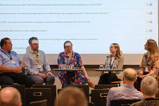
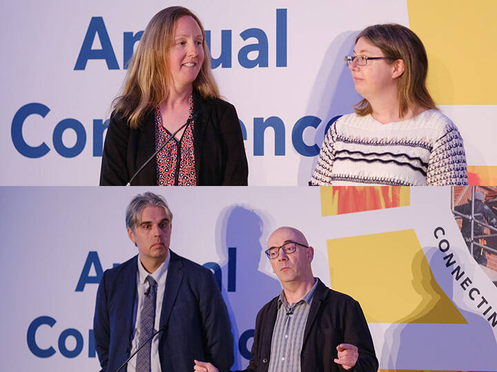
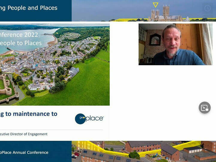
GeoPlace Conference 2025 - Connecting People and PlacesNick Chapallaz, Managing Director of GeoPlace, opened the 2025 GeoPlace Annual Conference with a warm welcome and a promise of a packed, purposeful agenda.

25 July 2025
Data underpinning growthThe write up of the 'Data underpinning growth' session at the GeoPlace 2025 annual conference.
25 July 2025
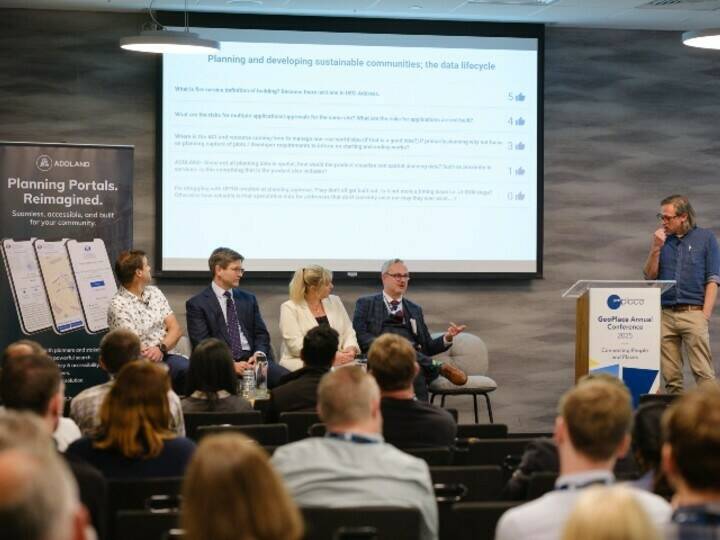
Planning and developing sustainable communitiesThe write up of the 'Planning and Developing Sustainable Communities' session at the GeoPlace 2025 annual conference.

25 July 2025
From data to deliveryThe write up of the 'From data to delivery' session at the GeoPlace 2025 annual conference.

25 July 2025
A connected street naming and numbering landscapeThe write up of the 'A connected street naming and numbering landscape' session at the GeoPlace 2025 annual conference.
25 July 2025
The Street Gazetteer - unlocking benefits to highways authoritiesThe write up of the 'The Street Gazetteer' session at the GeoPlace 2025 annual conference.

25 July 2025
Transforming processes at the Valuation Office AgencyThe write up of the 'Transforming Processes at the Valuation Office Agency' session at the GeoPlace 2025 annual conference.

25 July 2025
Shining a spotlight on local government’s best kept secretThe write up of the 'Shining a Spotlight on Local Government’s Best Kept Secret' session at the GeoPlace 2025 annual conference.
25 July 2025
Championing excellence and presentation of the Exemplar AwardsThe write up of the 'Championing excellence and presentation of the Exemplar Awards' session at the GeoPlace 2025 annual conference.

24 June 2025
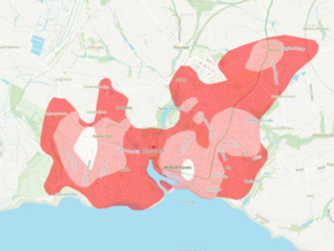
AI and geospatial intelligence transform public reporting in Westminster City CouncilWestminster City Council operates in one of the most complex and high-profile environments in the country, serving over 250,000 residents and millions of daily visitors. Maintaining public spaces is a continual challenge in such a densely populated and fast-moving area.

19 June 2025
Resilience in transition secures Gold at Lancashire County CouncilLancashire County Council found itself in a vulnerable position following a restructure and the retirement of key staff, which left its National Street Gazetteer (NSG) function without continuity, training, or handover.

18 June 2025
Data consolidation powers a successful transition to unitary in Somerset CouncilAs part of the Local Government Reorganisation (LGR) in Somerset, five legacy councils were brought together to form a single unitary authority.

05 June 2025
Cross-referencing commercial data unlocks millions in revenue in Camden Borough CouncilCommercial premises frequently change use, are repurposed, or disappear altogether – and the separate operation of the National Non-Domestic Rates (NDR) system meant that some properties could fall between the cracks.

09 May 2025
Life cycle data management in practice: Rochdale’s integrated approach to property and street recordsThis best practice case study explores an example of how Rochdale has significantly benefited from having processes in place to record the life stage of all streets and properties in the authority.
16 April 2025
UPRNs at the core: How Reigate & Banstead is transforming key resident servicesBy building a digital system anchored around individual properties, the council delivers fast, accurate, and personalised content. The result is a service that’s simpler for residents to use and far more scalable and sustainable for the council.

18 March 2025
Address Data Spotlight: Fire and Rescue Service Data InteractionAs active users of location data, Lancashire Fire and Rescue Service (LFRS) are in a unique position. They can both use the data and also provide candidate feedback where necessary. This spotlight piece explores this interactive relationship, and the benefits for both LFRS and the local authorities in their area.

10 January 2025
First homes built on UPRNsHomes England developed its ‘First Homes’ scheme with a simple aim: to help people get on the housing ladder. It's underpinned by Digital Property Logbooks, and the UPRN

19 September 2024
Completing an Authority Merger in SomersetIn late 2022, the process began to merge a series of councils into a new Unitory authority of Somerset. Uniting four district authorities and a county council is inevitably a big challenge.

11 July 2024
Leveraging data for better housing conditions: damp and mould management in the London Borough of HackneyData insights has become a critical tool for identifying and addressing housing issues efficiently in the London Borough of Hackney.

10 July 2024
Delivering connections between people and placesThe write up of the 'Delivering connections between people and places' session at the GeoPlace 2024 annual conference.

10 July 2024
Addressing digital planning transformation through 3DThe write up of the 'Addressing digital planning transformation through 3D' session at the GeoPlace 2024 annual conference.

10 July 2024
Digitalising the Property MarketThe write up of the 'Digitalising the Property Market' session at the GeoPlace 2024 annual conference.

10 July 2024
Healthy and green communitiesThe write up of the 'Healthy and green communities' session at the GeoPlace 2024 annual conference.

10 July 2024
Championing ExcellenceThe write up of the 'Championing excellence' session and presentation of Awards at the GeoPlace 2024 annual conference.

10 July 2024
Connecting services to customersThe write up of the 'Connecting services to customers' session at the GeoPlace 2024 annual conference.

24 June 2024
Improvements in data quality deliver efficiency and reduce riskWaverley Borough Council is the winner of GeoPlace’s 2024 Exemplar Award for its outstanding work in producing and maintaining high quality data, working towards data integration and delivering best practice. Read the Award winning case study.

12 June 2024
Data linking improves efficiency and collaboration in Lewisham CouncilLewisham Council’s asset management's data was being managed independently of the Local Land and Property Gazetteer (LLPG). This created issues with changes to property type and size, ownership types and transfers and relationships with other property teams. The council's GIS team worked closely with vendors to create a user friendly system that has delivered welcome improvements to the ways in which Lewisham Assets are now being managed and maintained.

10 June 2024
Census review work improves funding allocations for Royal Borough of Kingston upon Thames and London Borough of SuttonThe address management team ensured that address data was as accurate as possible prior to the 2021 census. The increase in data quality resulted in more accurate funding allocations and efficient services.

25 March 2024
Cumberland and Westmorland and Furness Councils: the process of splitting an authority’s gazetteer in CumbriaIn April of 2023, Cumbria split as an authority to become Cumberland and Westmorland and Furness. The local authority changes that Cumbria went through and the collaboration that took place in this change were a driving force in the successful split that was achieved.

12 February 2024
Data matching with UPRNs to identify likely HMOs in CroydonIt’s Croydon Council’s ambition to provide good housing services for residents of HMOs, making sure they can live in safe, secure, warm and dry homes.

18 January 2024
Using the HAUC App to keep vulnerable customers safe in HounslowA streetworks team in Hounslow had a customer who was blind, and some works interrupted his usual routine. The team used the HAUC App to guide them on how best to support this customer.

22 November 2023
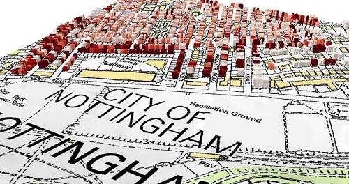
Nottingham City Council predicts impressive 6:1 ROI on use of address and street dataNottingham City Council is seeing impressive returns from its investment in geocoded address and street data, and the use of that data across the organisation. Results of an in-depth study show the council generated a significant Return on Investment.

15 November 2023
Qualitative use cases of the UPRN in NottinghamDuring a Return on Investment Analysis carried out in Nottingham, there were many social and environmental benefits identified during the study
15 November 2023
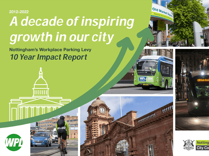
Workplace parking levy - a groundbreaking initiativeUPRNs bring certainty and credibility to Nottingham's Workplace Parking Levy

15 November 2023
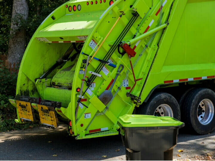
Waste management crews access routes and addressesWaste management is a one of the most visible of functions that the council delivers It is also labour intensive. Small amounts of time saved and reducing the number of repeat visit required has significant impact on costs.

15 November 2023
Safer housing - managing privately rented accommodationThe Safer Housing team in Nottingham City Council manage thousands of licensing applications and checks per year. Using the UPRN helps them to make huge gains in efficiency, both in cost and time saved.

15 November 2023
Identifying families in need through children's social care & early help servicesThe Supporting Families Programme helps identify those families most at need. In providing these families subsequent effective, whole family support at the earliest possible opportunity, escalation into statutory services can be prevented.

15 November 2023
Increasing business rates revenue in NottinghamThe use of UPRNs to link different authority systems brings with it the ability to increase and improve revenue collection of business rates.

15 November 2023
Data integration - saving £2.4million in NottinghamThe ability to integrate datasets using the UPRN and USRN adds significant value, saving time, money and effort

17 October 2023
DataVia – unlocking hidden benefits for Monmouthshire residentsMonmouthshire County Council is saving time and money with automation workflows that pull data directly from DataVia into its internal web mapping site.

12 October 2023
Freedom Fibre supercharges connectivity with DataViaFreedom Fibre is using GeoPlace’s DataVia API to plan the rollout of its full fibre, high-speed broadband, with the aim of revolutionising phone and internet access in the UK.

19 July 2023
Traffic Sensitive Streets Review in DurhamDurham is a largely rural unitary authority in the north east of England. Following the 2022 ‘Response to street and roadworks further reforms’ from the Department for Transport (DfT), the number and nature of Traffic Sensitive Streets was due for review. This case study highlights some of the effective methods of reviewing sensitive streets data.

14 July 2023
UPRN Integration in Rushmoor’s Digital ServicesRushmoor Borough Council created a system to automate many elements of their waste management service. As a result, they've reduced calls about missing bins, and there's also been a larger uptake of the Bulky Waste and Garden Waste services. This brings in a significant amount of revenue for the council, which is being reinvested in service improvements for the community.

20 June 2023
Property, housing and riskThe write up of the opening session, Day 1, Session 1, of the GeoPlace 2023 annual conference, on the theme of property, housing and risk.

19 June 2023
Climate change – improving our progressDay 1, Session 2, of the GeoPlace 2023 annual conference was on the theme of climate change. Read an overview of the topics here.

18 June 2023
Household Energy – developing data-driven insights to inform policyDay 1, session 3 of the GeoPlace conference featured insights into schemes that will improve energy efficiency in households, and how data supports that.

17 June 2023
Protecting our population, improving healthDay 1, session 4 of the 2023 GeoPlace conference focussed on using UPRNs to transform health and save lives.

16 June 2023
Transformation needs dataDay 2, session 1 of the GeoPlace conference featured leaders from local authorities discussing the part of data in transformation

12 June 2023
Street Naming & Numbering and the life cycle of streets & addressesDay 2, session 2 at the GeoPlace conference focussed on the lifecycle of data, and introduced the new Street Naming and Numbering Code of Practice.

09 June 2023
Products and Services for Local GovernmentDay 2, session 3 of the conference featured speakers from GeoPlace and Ordnance Survey, talking about the latest products, services and innovations to help local government.

08 June 2023
The year aheadThe final session at the GeoPlace conference on day 2 looked ahead to the coming year, with reflections and predictions from the Principal Chairs of local authority address and street groups, and members of GeoPlace.

02 June 2023
Making a difference to the local communityBirmingham City Council had a desire to reflect evolving demographics in street names, but the City's street naming and numbering policy needed to be updated to enable this.

02 June 2023
Saving £2m by integrating its Waste and Recycling Service with its LLPGLewisham Council linked data to be sure that households eligible for food and garden waste collection could access the appropriate services, but do so without incurring additional costs.

01 June 2023
Income-generating integration of planning applications with SNN processesBy developing an online application on the council’s website, Lewisham’s approved planning applications now trigger the Street Naming and Numbering (SNN) Application process automatically. It also shares the information with the Local Land and Property Gazetteer (LLPG) which is integrated with the council’s building control, land charges, environment health, council tax, electoral registration, refuse collection and CRM systems.

31 May 2023
Development of GIS as a key service for Maldon District CouncilThe recent launch of its new Internal mapping solution 'Phoenix Maps' is transforming the way Maldon District Council works with spatial information. Built with the ArcGIS Enterprise 11 hub, the new system links into well maintained data, providing simple application-based solutions and tools initially for officers and councillors.

28 February 2023
UPRN: a golden thread for housing associationsThe challenges faced by housing associations range from providing good quality, affordable housing to the all-important need to meet fire and safety regulations, to aspirations regarding net zero and a transition to cleaner, greener housing provision. When analysis and data sharing can be delivered with confidence, providers can work more efficiently and in return deliver better services for residents.
13 February 2023
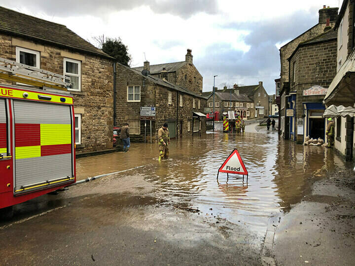
Protecting homes at risk of floodingIn order to help protect homes at risk of flooding in London, the Greater London Authority (GLA) compiled a single database using various sources of data, all linked by the Unique Property Reference Number (UPRN). This final list included over 45,000 addresses in London - not only basement properties but other properties over more than one floor that have basements, such as maisonettes.

02 February 2023
UPRNs facilitate energy retrofitting in NottinghamThe Nottingham City Council GIS Team has developed a property-based dataset for the Carbon Reduction Projects and Policy service area. Using Unique Property Reference Numbers (UPRN) to ensure validity and efficiency, this work supports the authority’s ambitious plan for energy retrofitting schemes.
20 January 2023
Interview: sharing data to support vulnerable people in WalesWelsh Government is using data-driven processes to inform planning and policymaking to support vulnerable people across Wales. To be effective, a multi-agency approach is essential for agility and speed of response. But how do multiple sets of information from multiple organisations link-up to ensure that the most vulnerable get the right support?

07 November 2022
The circle of address data: saving lives, probably every daySteve Taylor of Essex County Fire and Rescue Service discusses the importance of address data to the work of the fire service.

04 November 2022
Barnsley Council - using UPRNs to build a Vulnerability IndexBarnsley is the 38th most deprived local authority in the country and has a relatively high number of older residents: by 2040, it expects to have one third more residents aged 65 years or over. This places significant focus on finding efficient ways to serve the needs of an increasingly vulnerable population

04 October 2022
North Yorkshire Police uses UPRN to promote uptake of security measuresGIS has long been associated with crime mapping and analysis. Location data provides the means to visualise trends and patterns, identify hot spots, plan resources, and take preventative action associated with myriad aspects of law and order. Alcohol-related crime, for example. Anti-social behaviour knife crime, and public safety and welfare. In North Yorkshire, the Office of the North Yorkshire Police, Fire and Crime Commissioner (OFPCC) wanted to increase the uptake of local crime prevention measures. To do that, the team needed an insight.

13 July 2022
Deriving greater efficiencies and better quality through integration of UPRNsBlackburn and Darwen Borough have integrated Unique Property Reference Numbers (UPRNs) into the council’s elections process – realising immediate benefits. Ultimately, the council wants to incorporate UPRNs into all back-office systems.
12 July 2022
Mitigating risks to life from Ash Die Back diseaseConwy County Borough Council has undertaken an innovative spatial analysis of survey data, to identify and prioritise risks from Ash Die Back disease.

12 July 2022
Deriving multiple savings by integrating UPRNs into council systemsLeeds City Council has integrated Unique Property Reference Numbers (UPRNs) into its systems, providing a fuller picture of address data and assisting in asset management. The UPRNs also played an essential role in the council’s Covid response strategy.

07 July 2022
Increasing access to residential lettings’ data in ThanetThanet Council has delivered a map that can show privately rented homes to potential residents, so that they can see if the landlord has obtained a licence and is operating lawfully. They can also see if it meets their requirements by being near other local amenities such as schools, parks, shops etc.
07 July 2022
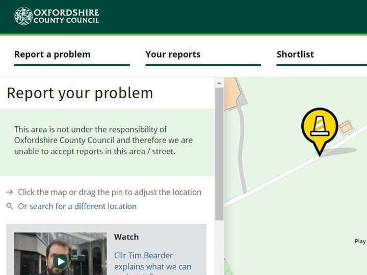
Improving council services in Oxfordshire by integrating the Street Gazetteer including FixMyStreetFixMyStreet is a tool that lets users map and report street problems to the councils responsible for fixing them. This includes potholes, broken streetlamps, dog fouling and issues with fencing.

05 July 2022
Overcoming multiple integration challenges in forming Buckinghamshire CouncilThe Buckinghamshire Council was merged from five councils, and the gazetteer team had to create a new Unitary Gazetteer. Read about the challenges they overcame to build this.

04 July 2022
Improvements in data quality deliver efficiency in DurhamWith the introduction of the street works permit scheme, Durham County Council’s Streetworks team were seeing an increase in permit assessments. By improving the data quality and quantity in the local Street Gazetteer, the team ensured it could then be better utilised to coordinate streetworks.

01 July 2022
Collaborative approach to improving data accuracy and quality in DurhamDurham developed bespoke scripts which they have shared with the wider DCA street community to respond to some of the additional data quality requests. This community focus of the way Durham have approached problems rightly deserves this highly commended Award.

31 May 2022
Warmer, more sustainable homes and buildingsThis session at the GeoPlace 2022 conference looked at energy use, warm home discounts and helping vulnerable families in fuel poverty.

31 May 2022
Stronger British infrastructureAt the 2022 GeoPlace conference, this session gave insights into the National Underground Asset Register, Project Gigabit (the network connections between people and premises), and Active Travel in Wales.

31 May 2022
Improving the property chainIn this session at the 2022 GeoPlace conference, four speakers discuss using the UPRN in the housing market, and talk about how processes have been and could be changed to make improvements.

31 May 2022
Safer, more secure homes and buildingsAt the 2022 GeoPlace annual conference, this session addressed issues around building safety in various contexts: a National Landlord Register, local authority information, the fire service, and the information that is needed to underpin building safety as a whole.

31 May 2022
Your data, supporting local public servicesAt the 2022 GeoPlace annual conference, three speakers addressed the theme of using location data to support local public services, making that data more accessible, and the benefits to everyone.
31 May 2022
From planning to maintenance to demolition, the life cycle of address and street dataThis session at the 2022 GeoPlace annual conference looked at the lifecycle of the UPRN, and the many different processes and organisations involved.

31 May 2022
Using UPRNs and USRNs to integrate data in your authorityAt the GeoPlace 2022 conference, this session focussed integrating data using UPRNs and USRNs, from a local authority perspective.
31 January 2022
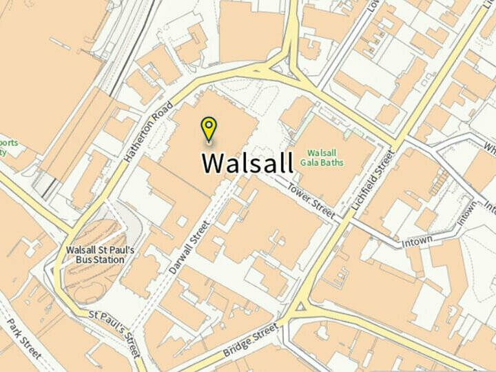
An integration story: improving services by integrating the LLPG into back-office systems at Walsall CouncilAs the Local Land and Property Gazetteer (LLPG) holds the definitive list of which properties (and their UPRNs) exist in any given area, it’s the obvious cornerstone for every local authority.


07 December 2020
Using the Local Land and Property Gazetteer to identify HMOs (Houses in Multiple Occupation)HMOs are an important form of accommodation. A building is classed as an HMO if it is let as a main or only home to at least three tenants forming more than one household. Large or small, they share facilities such as a kitchen, bathroom or toilet. HMOs with five or more tenants require a licence.

01 December 2020
Hidden value revealed by Government Digital ServiceGovernment Digital Service's (GDS's) Mandate for central government to use UPRNs and USRNs raises simple questions but provides astonishing answers.

26 November 2020
National Audit Office (NAO) – using UPRNs as best practiceHow the National Audit Office (NAO) use UPRNs, which uniquely identifies addresses, to overcome the inherent challenges in using location data & the derived benefits.

25 November 2020
UPRNs improve the UK's lettings market - Delivering immense benefits for landlords, tenants, government, and businessFind out how the innovative use of UPRNS improved the UK's lettings market delivering immense benefits for landlords, tenants, government, and business as a whole as well as bringing down overall costs and helping to support the market.
17 November 2020
Sefton Council uses the Local Land and Property Gazetteer to integrate key council services
Sefton Council uses the Local Land and Property Gazetteer to integrate key council services
Using-the-Local-Land-and-Property-Gazetteer-to-integrate-key-council-services_2020-11-17-110224.pdf
2.62 MB

27 October 2020
Traffic signals and the street gazetteer: protecting a valuable assetDetector loops are a common feature of many traffic light systems, but they can get damaged easily if street works’ teams don’t know where they are. The Traffic Signals Team at East Sussex Highways has been working with their local Street Custodian to accurately record the locations of these loops in the Local Street Gazetteer. The result is an instant reduction in costs for East Sussex Highways department.
13 October 2020
UPRNs – essential in shaping policy for on-street Electric Vehicle chargersElectric Vehicles (EVs) are gaining in popularity in the UK, which is good news for the planet. Those vehicles all need charging, regularly, so we also do to have the right charging infrastructure in place – easily-accessible chargers in the right place for as many people as possible.

04 September 2020
Using granular data to predict travel patternsA strategic transport model is a complex thing. To build a compelling narrative that examined the economics of a new pan-Northern strategic transport improvement scheme, Transport for the North needed to understand who’d be using it, how, what their experiences would be like, and what shape the travel market was in.

13 July 2020
Using the Local Street Gazetteer to develop a ‘smart city’The Internet of Things is a system of connected machines and computers that works without human intervention. Many of the devices linked to or by the Internet of Things are referred to as ‘smart’ devices, and Hull City Council is developing a city-wide smart operating system, known as City OS.
07 July 2020
The Unique Property Reference Number: a game changer for the lettings industryThe TLIC comprises lettings experts from across the industry, including professional bodies and schemes, service providers for both landlords and tenants, and representatives from both large and small lettings agents. Government advisors also proactively attend the meetings enabling two-way feedback on current issues. Members are united by their desire to help standards rise across lettings and this wide group represents the views of all parties in the private rented sector.


06 June 2020
Bridging central and local government with UPRNs to respond to COVID-19GeoPlace is working with central and devolved governments to include the UPRN in data sent to local authorities to support shielding measures for vulnerable people to COVID-19.
11 May 2020
Using UPRNs to engage with landlords and improve the quality of Houses in Multiple Occupation (HMOs)A House in Multiple Occupation (HMO) throws up many challenges for any organisation or company that’s involved in its administration, billing, or maintenance. This includes local authorities that want to support and engage with landlords in the private sector.

07 May 2020
Barnsley Council use the UPRN to identify vulnerable individuals and provide support during the Covid-19 pandemicThe Council opted to build a Vulnerability Index. The Unique Property Reference Number (UPRN) played a key role in the development of the Index, which was a composite of 26 different data sources – all combined through their common location.

06 May 2020
Durham County Council combines datasets using the UPRN to assist vulnerable residentsWith the onset of Covid-19 Durham County Council needed to identify vulnerable individuals in the area and target them with specific assistance services. Shielded population lists were a starting point, but the data team knew that there were vulnerable residents who were not on this list.

05 May 2020
Leeds City Council uses UPRNs to identify shielding individuals during COVID-19In March 2020 with the onset of COVID-19 Leeds City Council needed to identify clinically extremely vulnerable (CEV) who had particular health conditions. Prior to this, there were 18,000 individuals on the CEV list. However this list grew vastly to 40,000 in April 2020. The council needed to make a plan of action to support these people.

04 May 2020
Mole Valley’s use of UPRNs to link datasets to support clinically extremely vulnerable peopleMole Valley District Council believed that if NHS shielding datasets were linked to UPRNs, their support of extremely vulnerable residents in the district would be improved.

03 May 2020
Using property identifiers to locate vulnerable people in Sedgemoor District in SomersetThe COVID-19 pandemic highlighted the key importance of data held by local authorities in identifying and supporting vulnerable residents. Local Authorities in Somerset needed to contact those residents who were not already covered by the national NHS shielding programme but were nonetheless situationally vulnerable.

02 May 2020
Sheffield’s linking of UPRNs to council tax data to support over 70’s living aloneAt the start of COVID-19 the council wanted to identify over 70s living alone to ensure they were given sufficient support. However, the council didn’t have an effective way of identifying this target group. Sheffield City Council had access to council tax data but didn’t have a link to the UPRN to enable the data to be linked to other systems within the organisation.

01 May 2020
Predicting longer-term care needs using UPRNsWorcestershire County Council saw a need to develop improved foresight relating to demands on services. One approach the council took was to predict longer-term care needs of individuals in the area. Risk stratification was employed to identify households in Worcestershire that were likely to require support from adult social care in the future.
02 April 2020
Local authorities are using UPRNs to provide support for vulnerable peopleEvery business and organisation wants to move faster and deliver better results. As Covid-19 is a threat to us all, it’s never been more important to understand who needs help – to identify the most vulnerable people in our communities – and to give them the joined-up, practical support they need. The Unique Property Reference Number (UPRN) has an invaluable role to play in making this achievable, with confidence.

02 April 2020
Hackney Council use UPRNs to support vulnerable peopleHackney Council are using the UPRN to identify the most vulnerable people in our communities and to give them the joined-up, practical support they need.
26 March 2020
What can food hygiene tell us about fire safety?GeoPlace partnered with the National Fire Chiefs Council to examine the benefits a focus on the UPRN can bring to improving fire safety in communities. Richard Duffield, Senior Consultant at GeoPlace and Catherine Levin Communications Adviser from the National Fire Chiefs Council provided this report.
03 March 2020
Working for the local communityWest Yorkshire councils collaboration with the emergency services is leading to better quality location data
13 February 2020
Using the UPRN to improve collection of Land Transaction Tax in Wales
In Wales, land transaction tax (LTT) replaced stamp duty from April 2018. The tax used to support public services in Wales, so it is important to government, to citizens and business as property buyers, users of public services and tax payers that the LTT process is both quick and accurate.
using-the-uprn-improves-collection-of-land-transaction-tax-in-wales.pdf
9.73 MB
13 February 2020
Defnyddio’r Rhif Cyfeirnod Eiddo Unigryw (UPRN) i wella casglu Treth Trafodiadau Tir yng Nghymru
Welsh language case study
defnyddior-rhif-cyfeirnod-eiddo-unigryw-uprn-i-wella-casglu-treth-trafodiadau-tir-yng-nghymru.pdf
9.74 MB

11 February 2020
Combining the systems from five established local authorities in DorsetDorset combines six authorities: Dorset County Council, East Dorset District, North Dorset District, Purbeck District, West Dorset District, Weymouth & Portland Borough- to become a single unitary authority.
28 January 2020
Milton Keynes Council uses drones to monitor development sitesMilton Keynes Council has developed an innovative approach to monitoring development sites with the use of drone technology, enabling them to pre-empt citizen's needs.
28 January 2020
Using addresses in the police servicePolice forces use addresses and location information in almost every aspect of law enforcement; from keeping accurate records on the addresses of victims and witnesses or suspects and offenders, to using the exact location of a crime or incident to verify an alibi, or to subsequently shape a crime-prevention policy.

05 September 2019
Ofcom - using UPRNs to help deliver superfast, universal service obligations and mobile coverageGood communication is vital in our lives. Ofcom makes excellent use of Unique Property Reference Numbers (UPRNs) in AddressBase Premium and AddressBase Islands to ensure its policy analysis is dependable and authoritative.
25 June 2019
Nottingham lead the way for smart city technology and renewable energy
Nottingham City Council are pioneering smart cities with their app to manage their district heating system using FME integrated data technology. They have combined their district heating network data with the National Street Gazetteer (NSG) to create a visual resource for safer street works.
Nottingham-smart-city.pdf
2.99 MB
19 May 2019
Improving services for citizens with one version of the truth
The Welsh Government works to provide citizen-focused benefits across a wide variety of areas such as the environment; education and health. Decisions are made on these matters for Wales as a whole – with the devolved Government developing country-centric policies, laws, and assembly bills.
One-version-of-the-truth-improving-services-for-citizens-Welsh-Government.pdf
544.26 KB
09 May 2019
Generating revenue, improving services for citizens using the UPRN
At a time when authorities are under pressure to make savings, the City of Wolverhampton Council started charging customers to collect their garden waste. It was imperative for this income to generate a positive return: it couldn’t result in costs being incurred elsewhere – in Customer Services, for example – due to an increase in calls. So a solution was needed that would help people self-serve and, if they didn’t have access to a computer, signpost them to a Customer Services Officer for a conversation.
Generating-revenue-improving-services-fro-citizens-using-the-UPRN.pdf
418.21 KB
09 May 2019
Using location to create understandable, shareable insights from complex raw information
Bringing Location to Life - case study based on a presentation from Wayne Brooks, Service Data Manager for Highways, Devon County Council at the GeoPlace conference 2019
Using-location-to-create-understandable-shareable-insights-from-raw-complex-information.pdf
412.49 KB
09 May 2019
Addressing the Census
Bringing Location to Life - case study based on a presentation from Jez Halton, Senior Research Officer, Address Register, Data Architecture, Office for National Statistics at the GeoPlace conference 2019
The-Office-for-National-statistics-will-rely-on-the-authoritative-data-from-AdressBase-as-the-Address-Index-for-the-2021-Census.pdf
273.98 KB
09 May 2019
Waste Collection Services Incab System
Bringing Location to Life - case study based on a presentation from James Atthews, Management Support Analyst and LLPG Custodian, Scarborough Borough Council at the GeoPlace conference 2019
Waste-Collection-Services-Incab-System.pdf
376.23 KB
09 May 2019
Reducing costs and improving services to citizens using the UPRN
Bringing Location to Life - case study based on a presentation from Nizete Vasconcelos, GIS Manager and Petri Iivonen, Web Developer, Tonbridge and Malling Borough Council at the GeoPlace conference 2019
reducing-costs-improving-services-to-citizens-using-the-uprn.pdf
337.29 KB
09 May 2019
Integrated location delivers greater reliability and interoperability
integrated-location-delivers-greater-reliability-and-interoperability.pdf
433.16 KB
09 May 2019
HMRC - Working across government, tackling and preventing fraud using the UPRN
Case study based on a presentation from Andrew Letherby, Head of Monitoring, Digital Operations, HMRC at the GeoPlace conference 2019
bringing-location-to-life-working-across-government-tackling-and-preventing-fraud-using-the-uprn.pdf
437.99 KB
09 May 2019
Environment Roads and Facilities (ERF) digital transformation project
Bringing Location to Life - case study based on a presentation from Sophie Birchall-Rogerson, Senior Management Information Systems Officer, Conwy County Council at the GeoPlace conference 2019
bringing-location-to-life-environment-roads-and-facilities-digital-transformation-project.pdf
697.77 KB
09 May 2019
Predicting and preventing fires using predictive analytics and the UPRN
Bringing Location to Life - case study based on a presentation from Apollo Gerolymbos, Head of Data Analytics at London Fire Brigade at the GeoPlace conference 2019
116a1a749aef1c39edc2bfe312f39baf47f2658f-v3.pdf
361.88 KB
09 May 2019
Using location data and technology of today to reveal the secrets of the past
using-location-data-and-technology-of-today-to-reveal-the-secrets-of-the-past.pdf
413.09 KB
09 May 2019
How to avoid letting off steam
Bringing Location to Life - case study based on a presentation from Gareth Osborne, Senior Address Management Officer, Nottingham City Council at the GeoPlace conference 2019
Sharing-data-securely-bringing-down-costs-protecting-information-by-using-the-UPRN_200724_104211.pdf
372.66 KB
09 May 2019
Tertiaries 'R' Us
Bringing Location to Life - case study based on a presentation from Mary Burton, Address Management Officer, Nottingham City Council at the GeoPlace conference 2019
Improving-tertiary-classifications-and-realising-greater-confidence-in-associated-analysis.pdf
210.81 KB
09 May 2019
Using the UPRN to scrutinise government activity and understand delivery at a local level
Bringing Location to Life - case study based on a presentation from Dr Marc Adams, Senior Analyst and MESH Mapping Lead, National Audit Office at the GeoPlace conference 2019
Using-the-UPRN-to-scrutinise-government-activity-and-understand-delivery-at-a-local-level.pdf
436.53 KB
07 March 2019
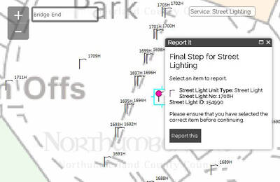
Highways Asset Management - Street Lighting PortalThrough creativity and innovative use of accurate geospatial data, Conwy has managed to transform and modernise their asset management system to work for them.
25 September 2018
Linking people and places The Nation’s Census Address Custodians are our unsung heroes
Our Address Custodians are a nationwide force to be reckoned with – and as experts in addressing, they’re likely to be the unsung heroes of the 2021 Census.
linking-people-and-places.pdf
468.70 KB
11 May 2018
Kent integrated Database – using the UPRN to support health and care providers
The Kent Integrated Databset (KID) is a whole population pseudonymised person level linked dataset based on data flows from hundreds of local health and care providers in Kent & Medway
connecting-data-for-better-outcomes-9.pdf
1.62 MB
10 May 2018
Mid Sussex District Council - using UPRNs to secure £2.2m Government funding for local broadband improvements
Linking people and places - case study from Exemplar Awards 2018
linking-people-and-places-1.pdf
2.49 MB
10 May 2018
London Borough of Lewisham uses UPRNs to transform borough-wide services for residents
Linking people and places - case study from London Borough of Lewisham for GeoPlace Exemplar Awards 2018
linking-people-and-places-5.pdf
785.61 KB

 View more like Sefton Council - UPRNs help to improve the standard of living in rented accommodation
10 May 2018
Sefton Council - UPRNs help to improve the standard of living in rented accommodation
Linking people and places - case study from Sefton Council for GeoPlace Exemplar Awards 2018
linking-people-and-places-4.pdf
569.64 KB
10 May 2018
Reigate & Banstead Council - using UPRNs to ensure electoral equality and empower insight
Linking people and places - case study from Reigate & Banstead Council for GeoPlace Exemplar Awards 2018
linking-people-and-places-3.pdf
835.62 KB
10 May 2018
Denbighshire County Council - using UPRNs to secure funding and improve tenants’ housing conditions
Linking people and places - case study from Denbighsire County Council for GeoPlace Exemplar Awards 2018
linking-people-and-places-2.pdf
607.35 KB
10 May 2018
Rhondda Cynon Taff County Borough Council - UPRNs make waste collection operations more efficient
Linking people and places - case study from Rhondda Cynon Taff County Borough Council for GeoPlace Exemplar Awards 2018
linking-people-and-places-7.pdf
824.18 KB
10 May 2018
UPRNs can deliver better outcomes for vulnerable individuals by improving the efficiency of emergency services
Linking people and places - case study from the Joint Emergency Services Group Wales (JESG) for GeoPlace Exemplar Awards 2018
UPRNs-can-deliver-better-outcomes-for-vulnerable-individuals-by-improving-the-effiency-of-emergency-services.pdf
3.19 MB
10 May 2018
North Somerset Council - UPRNs identify missing Business Rates and Council Tax revenue streams
Linking people and places - case study from North Somerset for GeoPlace Exemplar Awards 2018
linking-people-and-places-6.pdf
548.35 KB
26 February 2018
How the UPRN unlocks data
how-the-uprn-unlocks-data.pdf
544.86 KB

04 January 2018
Collecting waste from houses in multiple occupation made easyIn 2010, Oxford City Council implemented a new domestic and trade waste recycling software system. This system was designed to be underpinned by the Local Land and Property Gazetteer (LLPG).
04 January 2018
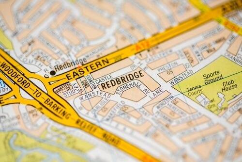
The London Borough of Redbridge and how they used the LLPG for their 2016 Ward Boundary ReviewThe London Borough of Redbridge have used their Local Land and Property Gazetteer (LLPG) matched Electoral Roll to help model submissions for the 2016 Ward Boundary Review.

27 November 2017
Entering PRoW and its subsequent benefits for street works coordinationThe New Roads and Street Works Act (NRSWA) Codes of Practice states; It is a local highways authoritys responsibility to create and maintain street gazetteer data for all streets within its geographical area, whether or not it is a the street authority for any particular street.

25 October 2017
The Camden Residents IndexIn 2013, the London Borough of Camden developed a Residents Index using a Master Data Management (MDM) platform. The Camden Residents Index (CRI) unites information from multiple council data sources to create a single, consistent view of residents across the borough and the council services that they are accessing. The system uses sophisticated probabilistic matching techniques to link records from different business system together to produce a single golden view of the citizen and the household.

09 October 2017
Using the UPRN to service customers better in Salford
As with many other local authorities in England and Wales, Salford City Council faces challenges to reduce costs whilst improving levels of customer satisfaction.
Salford-City-Council-Using-the-UPRN-to-better-service-customers.pdf
998.30 KB

09 October 2017
Building a Street Naming and Numbering SystemFor many years Bath and North East Somerset (BANES) Council operated a paper-based Street Naming and Numbering (SNN) system. It became increasingly untenable with the expansion in workload, the need to cut administration costs, and the desire from applicants to apply and pay on line.
21 September 2017
Simulating the energy use of buildings in the City of Nottingham - The InSmart projectInSmart -Integrated Smart City Planning is a three year, European funded project which involves four European Cities working in partnership towards a sustainable energy future. The primary objective of the project is to develop sustainable energy action plans for each partner city.
10 July 2017
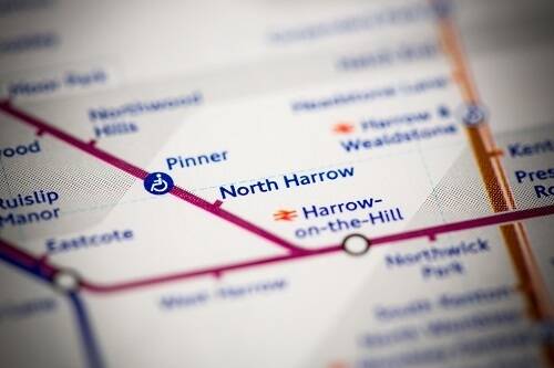
Real time intelligence on Data Linking in HarrowThe London Borough of Harrow have created an internal dashboard as a simple and effective way to provide instant information about systems linked to their Local Land and Property Gazetteer (LLPG) across the council.
11 May 2017
Brighton & Hove City Council - Using UPRN as the key to creating a unified Customer Index
Connecting Data for Better Outcomes - case study from Brighton and Hove City Council for GeoPlace Exemplar Awards 2017 which focusses on using UPRN as the key to creating a unified Customer Index
using-the-uprn-as-the-key-to-creating-a-unified-customer-index.pdf
507.21 KB
11 May 2017
Rushmoor Borough Council – Increasing customer satisfaction with UPRNs
Connecting Data for Better Outcomes - case study from Rushmoor Borough Council for GeoPlace Exemplar Awards 2017
connecting-data-for-better-outcomes-7.pdf
2.04 MB
11 May 2017
Manchester City Council — Using the UPRN to identify families with troubles
connecting-data-for-better-outcomes-3.pdf
2.86 MB
11 May 2017
Harrow Council – the UPRN, the logical glue, or “How I was converted to understand the importance of the LLPG”
Connecting Data for Better Outcomes - Taken from a presentation by Ben Jones, Head of Digital Services at Harrow Council at the GeoPlace annual conference, 11th May 2017.
connecting-data-for-better-outcomes-4.pdf
1.51 MB
11 May 2017
Brighton & Hove City Council – using the USRN to light up the city
Connecting Data for Better Outcomes - case study from Brighton and Hove City Council for GeoPlace Exemplar Awards 2017 which focuses on using the USRN to light up the city
connecting-data-for-better-outcomes-6.pdf
3.33 MB
11 May 2017
Camden Council – creating a Residents’ Index using the UPRN
In 2013, the London Borough of Camden developed a Residents Index using a Master Data Management (MDM) platform. The Camden Residents Index (CRI) unites information from multiple council data sources to create a single, consistent view of residents across the borough and the council services that they are accessing.
connecting-data-for-better-outcomes-8.pdf
3.64 MB
10 May 2017
Bath & North East Somerset Council - Using UPRNs to improve business rate collection
Connecting Data for Better Outcomes - case study from Bath & North East Somerset Council for GeoPlace Exemplar Awards 2017
connecting-data-for-better-outcomes-5.pdf
4.59 MB
10 May 2017
Salford City Council - Using the UPRN to better service customers
Connecting Data for Better Outcomes - case study from Salford City Council for GeoPlace Exemplar Awards 2017
connecting-data-for-better-outcomes-2.pdf
998.30 KB
02 May 2017
Understanding local populations between censusesKnowing the characteristics of the entire population is key for the development of public policy. The decennial census provides a snap-shot of all people and households in a particular area and has a direct bearing on the government support that councils receive to fund public services.

29 March 2017
Workshopping standardised geospatial data for local public servicesA workshop on how the UPRN can be better shared inside and between public service organisations on a royalty free basis.
15 March 2017
Increasing customer satisfaction with UPRNs
The UPRN has now evolved to be part of most council functions at Rushmoor. This has included creating the In my area' tool on their website, designed to increase customer satisfaction and improve local information, built on data using the UPRN.
Rushmoor-Borough-Council-–-Increasing-customer-satisfaction-with-UPRNs.pdf
2.04 MB
18 January 2017
Northumberland makes online reporting easyNorthumberland County Council achieved digital transformation in their online reporting tools aimed at residents. The tool can be used to report street lighting faults; missed bin collections or potholes. The tool has achieved efficiencies for the authority as well as an improved customer experience. All this has been enabled through effective use of existing resources, including the Local Land and Property Gazetteer (LLPG) and the Local Street Gazetteer (LSG).

30 December 2016
The UPRN underpinning the Multi Agency Incident Transfer (MAIT) standardBritish APCO has been working with the Cabinet Office, Welsh Government and ACPO members from both the emergency services and the commercial sector to look at the problem of exchanging incidents between agency control rooms.

05 October 2016
Using UPRNs to improve business rate collection
In line with other authorities, Bath and North East Somerset Council have been faced with a decrease in government funding. In response, the council chose to raise income, and minimise cuts to their services.
Bath-North-East-Somerset-Council-Using-UPRNs-to-improve-business-rate-collection.pdf
4.59 MB

03 October 2016
GeoPlace Exemplar Award Winner 2016 - Leeds City CouncilThe Exemplar Award is awarded to the best example or demonstration of local address and/or street datasets providing quantifiable benefit to the citizen/authority/region/nation. This year's winner is Leeds City Council for its project to use local address data to verify population estimates. By using accurate data on the number of residential units, where they are located, and which ones are vacant, a far more accurate population estimate is able to be calculated at any period of time.

11 August 2016
Using the USRN to keep Brighton & Hove lit upBrighton & Hove Council are linking their street works information with the enhancement of the Street Lighting Inventory, for a more efficient process. This was particularly important to the street works engineers.

14 July 2016
Using addresses to transform business in Wiltshire
When Wiltshire County Council became a unitary authority, it inherited Local Land and Property Gazetteers (LLPGs) from its previous four district councils. The LLPG which now holds 250,000 addresses, has been integrated into a number of core business systems allowing the council to benefit from accurate addressing, reduce the duplication of effort and minimise the risk of errors as well as providing consistency for its customers.
Using-addresses-to-transform-business-in-Wiltshire.pdf
1.80 MB

14 July 2016
A property level view of flood relief in LeedsIn late December, 2015, Leeds City Council faced intense flash flooding within its area. Urgent action was needed to identify all affected buildings. The Business Rates and Council Tax departments needed to identify flooded areas in order to avoid any miscommunication with regards to missed payments and provide mandatory relief. The Unique Property Reference Number (UPRN) became a key driver in the assessment of the entitled relief for all residential and commercial properties.
14 July 2016
Huntingdon's use of Cambridgeshire County Council's Public Right of Way Data
huntingdonshires-use-of-cambridgeshire-county-councils-public-right-of-way-data.pdf
1.86 MB
14 July 2016
Evidence based procurement returns £800,000 per annum in Bromley
The London Borough of Bromley used their street data intelligence, in the form of the Local Street Gazetteer, to demonstrate excellence in digital transformation. As a result, the team at Bromley have delivered significant savings and service improvements.
evidence-based-procurement-returns-£800000-per-annum-in-bromley.pdf
2.90 MB

20 May 2016
Cheshire County Council's roadworks webpage
Cheshire County Council used new powers under the Traffic Management Act 2004 to control roadworks in the area. The council wanted to the public to be able to access present and planned roadworks information through the internet.
Cheshire-County-Council-roadworks-webpage.pdf
66.37 KB

20 May 2016
Sharing the knowledge in Oxford
Oxford City Council encourages sharing of information across departments, using geographical information systems (GIS) and a rationalised back office regime.
Sharing-the-knowledge-in-Oxford.pdf
172.91 KB

18 May 2016
GeoPlace identifies £4 return on every £1 spent on council address and street informationA GeoPlace commissioned study projects net benefits up to £202 million by 2020 from better use of the address and street data that councils create and maintain
27 April 2016
Using the UPRN as the key to creating a unified Customer Index
A case study of Brighton and Hove City Council’s work to create a single Customer Index using the UPRN (Unique Property Reference Number) as the unifying data key. This case study outlines the proactive work of the ICT Consultant Project Manager and IS Operations Manager in identifying and overcoming the specific set of challenges presented by the need to combine data from multiple disparate sources comprising multiple formats and record types into a single verified customer view. The case study examines the particular example of linking location data (the UPRN) to personal data to facilitate the data cleansing and matching processes, creating a Customer Index Record Number (CIRN). A key lesson has been the value of data matching from a location point of view but the case study also demonstrates the value of harmonising information within a council.
using-the-uprn-as-the-key-to-creating-a-unified-customer-index.pdf
507.21 KB

19 January 2016
Hints and tips to improve your address data quality
Hints and tips from fellow Authority Address Custodians
How-to-improve-your-address-data.pdf
1.38 MB
19 January 2016
Non-Domestic Rates - maintenance and benefits of the data
an-exploration-of-the-best-process-for-keeping-non-domestic-rates-data-up-to-date-and-the-potential-benefits.pdf
1.45 MB
19 January 2016
Promoting address and street data within your authority - a 'how to' guide
This paper provides a structure to help create the case to convince internal managers and stakeholders of the benefits and value of integrating street and address data into their systems and processes.
promoting-address-and-street-data-within-your-authority-a-how-to-guide.pdf
1.50 MB
19 January 2016
Linking internal systems within your authority - benefits and considerations
There are considerable financial and service provision benefits for local authorities who have a high number of linkages between their Local Land and Property Gazetteer (LLPG) and other council systems:
linking-internal-systems-within-your-authority-benefits-and-considerations.pdf
952.60 KB

08 December 2015
Linking essential services in WychavonThe address team at Wychavon District Council carried out an extensive data cleansing exercise of the authority address data. Through the improved data quality, the team can support digital transformation by using the validated address data to link up information across the authority to provide a consistent, joined-up view of data.

16 November 2015
Routes to school in Newham powered by the Unique Property Reference Number (UPRN)Newham has developed an external web application, powered by the UPRN, which has enabled the school admissions team to work more efficiently, accurately and provide more transparency in admissions.

29 July 2015
Registering land in Oxford City CouncilOxford City Council has a significant land holding portfolio, a large percentage of which were not registered with the Land Registry. This case study describes how Oxford has made their register of property holdings electronic and accessible:
29 July 2015
Supporting the electoral process in Northumberland County CouncilBoundary changes and the introduction of the Individual Elector Registration initiative in 2014 led to significant changes in how the elections function was supported by the Information Management team

25 July 2015
Linked data in Barnsley - creating a case for troubled families supportBarnsley utilised the Unique Property Reference Number (UPRN) to link disparate data sources to create a view of families in the borough.

04 June 2015
A council's approach to utilising Additional Street DataIn being a Permit scheme authority, the council is able to rely on accurate information from works promoters before carrying out work. This is because, the permit scheme provides a more formal way of booking time/road space on Highways.
17 July 2014
The role of 'place' in improving public services
the-role-of-place-in-improving-public-services.pdf
4.03 MB
29 October 2013
Case study - GeoPlace supporting authorities
GeoPlace works with local authorities to produce a National Address Gazetteer infrastructure. This work is of huge value locally and nationally. Key to this is the collaborative approach taken between GeoPlace and local authorities.
geoplace-supporting-authorities.pdf
3.27 MB
19 October 2013
Most Improved Street DataExemplar Award Winner- Most Improved Street Data Winner: St Helens Metropolitan District Council

18 October 2013
Most Improved Address DataExemplar Award Winner- Most Improved Address Data Winner: North Devon Council

15 October 2013
A history of steam in NewportExemplar Award winner- Street Naming and Numbering Award Highly Commended 2013: Newport City Council

14 October 2013
Retaining social history in ChelmsfordExemplar Award Winner- Street Naming and Numbering Award Runner-up 2013: Chelmsford City Council

12 October 2013
Village greens in Northumberland County CouncilExemplar Award Winner- Best Practice Award Highly Commended 2013: Northumberland County Council

12 October 2013
Creating a spatial data infrastructure in North SomersetExemplar Award Winner- Best Practice Award Runner-up 2013: North Somerset Council

11 October 2013
Cleaning up commercial addresses in Nottingham City CouncilExemplar Award Winner- Best Practice Award Winner 2013: Nottingham City Council

10 October 2013
Joining it all up in North SomersetExemplar Award Winner- Innovation in Delivery Award Runner-up 2013: North Somerset Council

09 October 2013
Automated Land Charges in London Borough of Tower HamletsExemplar Award Winner - Innovation in Delivery Award Winner 2013: London Borough of Tower Hamlets

08 October 2013
Managing Waste in ColchesterExemplar Award Winner- Integration Award Runner-up 2013: Colchester Borough Council

07 October 2013
Improving data, improving waste collection in North SomersetExemplar Award Winner- Integration Award Joint winner: North Somerset Council

07 October 2013
Improved understanding of residents in the London Borough of NewhamExemplar Award Winner- Integration Award Joint winner 2013: Newham Council

05 October 2013
Huntingdonshire District Council tackle social housing fraudExemplar Award winner- Improvement and Efficiency Award Runner-up 2013: Huntingdonshire District Council

04 October 2013
Maximising local taxation revenues in Barnsley Metropolitan Borough CouncilExemplar Award Winner- Improvement and Efficiency Award Winner 2013: Barnsley Metropolitan Borough Council

03 October 2013
Parking in Tower HamletsExemplar Award Winner- Citizen Award Highly commended 2013: London Borough of Tower Hamlets

02 October 2013
Rethink your rubbish … recycle moreExemplar Award Winner- Citizens Award 2013: Reigate and Banstead Borough Council

01 October 2013
Delivering waste management service efficiencies through the use of GIS and route optimisation in South StaffordshireExemplar Award Winner - Citizen Award 2013: South Staffordshire Council

01 October 2013
Keeping names local in CambridgeExemplar Award Winner- Street Naming and Numbering Award Winner: Cambridge City Council
17 July 2013
Driving efficiency through improvement and innovation
GeoPlace’s annual conference and presentation of the Exemplar Awards 2013 took place at the Institute of Education in London on Wednesday 9th October 2013 with 315 local authority delegates in attendance.
driving-effiency-through-improvement-and-innovation.pdf
3.79 MB
21 January 2013
Salford City Council - making the most of its knowledge
Salford's local address and council tax teams shared their address intelligence to ensure the council has maximum understanding of the changes in the city and in turn ensure residents pay the appropriate council tax revenues and receive the services they require. The improved working arrangements lead to outstanding queries being reduced by 43% over a 5 month period.
Salford-City-Council-making-the-most-of-its-knowledge.pdf
2.47 MB
29 October 2012
Leeds match data to uncover council tax revenue
leeds-city-council-the-benefits-of-data-matching.pdf
2.83 MB
25 October 2012
Using local knowledge for national benefit
On 25th October, with an estimated 1500 years’ worth of addressing and street data expertise gathered together in one room, the GeoPlace annual conference and presentation of the Exemplar Awards was the place to be for anyone interested in the creation and usage of these core geographic reference data sets.
using-local-knowledge-for-national-benefit.pdf
8.26 MB

19 October 2012
Island of the DeadExemplar Award Winner- Winner Best anecdote for widespread use of a UPRN or USRN 2012: Northumberland County Council

18 October 2012
Leading the regionsExemplar Award Winners 2012- • Best in East Midlands Region Authority Address Updates: Derbyshire Dales District Council • Best in East of England Region Authority Address Updates: Broxbourne Borough Council • Best in Greater London Region Authority Address Updates: London Borough of Enfield • Best in North East Region Authority Address Updates: Stockton-on-Tees Borough Council • Best in North West Region Authority Address Updates: Salford District Council • Best in South East Region Authority Address Updates: Lewes District Council • Best in South West Region Authority Address Updates: South Gloucestershire Council • Best in Wales Region Authority Address Updates: Bridgend County Borough Council • Best in West Midlands Region Authority Address Updates: Wychavon District Council • Best in Yorkshire and Humber Region Authority Address Updates: Leeds City Council • Best in Yorkshire and Humber Region Authority Street Updates: Calderdale Metropolitan Borough Council • Best in East Midlands Region Authority Street Updates: Rutland County Council and Derby City Council • Best in East of England Region Authority Street Updates: Peterborough City Council • Best in Greater London Region Authority Street Updates: London Borough of Enfield • Best in North East Region Authority Street Updates: Northumberland County Council • Best in North West Region Authority Street Updates: Warrington Borough Council • Best in South East Region Authority Street Updates: West Sussex County Council and The Royal Borough of Windsor and Maidenhead • Best in South West Region Authority Street Updates: Devon County Council • Best in Wales Region Authority Street Updates: Isle of Anglesey County Council • Best in West Midlands Region Authority Street Updates: Walsall Metropolitan Borough Council

17 October 2012
Advancing forward, demonstrating commitmentExemplar Award Winners- • Winner Most Approved Authority Address Updates: Cannock Chase District Council • Winner Most Approved Authority Street Updates: Peterborough City Council • Winner Best Contribution from a Scottish Authority in Preparation for AddressBase ™: North Ayrshire Council
15 October 2012
Sharing knowledge, raising awareness - Oxford City CouncilExemplar Award Winner- Winner Peer Award 2012: Cathy Coelho from Oxford City Council

14 October 2012
Streamlining developments in EnfieldExemplar Award Winner- Highly commended Best Example of Street Naming and Numbering Policy Implementation Award 2012: Enfield Council

13 October 2012
Building the foundations for property expansionExemplar Award Winner- Runner-up Best Example of Street Naming and Numbering Policy Implementation Award: Cambridge City Council and South Cambridgeshire District Council

12 October 2012
Communicating address informationExemplar Award Winner- Winner Best Example of Street Naming and Numbering Policy Implementation Award 2012: Adur and Worthing Councils

11 October 2012
Evidence based electoral reviewExemplar Award Winner- Highly commended Services Award: Gedling Borough Council

10 October 2012
Improving living standardsExemplar Award Winner- Runner-up Services Award: London Borough of Newham

09 October 2012
Letting the photos take the strainExemplar Award Winner - Winner Services Award 2012: Bath and North East Somerset Council

08 October 2012
Northumberland PRoWdly presentsExemplar Award Winner- Best practice Integration Award 2012: Northumberland County Council

07 October 2012
Connecting the middlemanExemplar Award Winner- Runner-up Integration Award 2012: Northumberland County Council

06 October 2012
There’s no Space Odyssey at HarrowExemplar Award Winner- Winner Integration Award and 2012 Exemplar 2012: London Borough of Harrow

05 October 2012
TOIDy Up Your DataExemplar Award Winner- Best practice Improvement and Efficiency Award 2012: Northumberland County Council
04 October 2012
Business Rates Address Management ToolExemplar Award Winner- Runner-up Improvement and Efficiency Award 2012: Nottingham City Council

02 October 2012
Business Improvement District Sees Almost £1m of Investment into HuntingdonExemplar Award Winner- Runner-up Citizen Award 2012: Huntingdonshire District Council

01 October 2012
Bringing history to lifeExemplar Award Winner- Winner Citizen Award 2012: Caerphilly County Borough Council

01 October 2012
The NSG ensured minimum disruption to the Olympic Route Network
Ensuring-minimum-disruption-tothe-Olympic-and-Paralympic-RouteNetworks-through-the-NSG.pdf
474.43 KB
30 August 2012
Northumberland Council - joining up intelligence for improved service delivery
Similarly, authorities have the responsibility to hold a definitive map detailing all public rights of way within the boundary.
joining-up-intelligence-for-improved-service-delivery.pdf
818.17 KB
01 August 2012
Working together for big returns - North and Mid Wales
North-and-mid-Wales-working-together-case-study.pdf
2.43 MB
29 July 2012
Worcestershire County Council One version of the truth
Worcestershire County Council is a diverse authority in the West Midlands containing both urban and rural areas. It has a population of 557,400 residents (2010 mid-year population estimates). Bromsgrove, Malvern Hills, Redditch, Worcester, Wychavon and Wyre District Councils all fall within the county boundary.
worcestershire-county-council-one-version-of-the-truth.pdf
763.72 KB

03 July 2012
Pothole repairs up, compensation claims downExemplar Award Winner- Improvement and Efficiency Award Winner: Kent County Council

09 April 2012
It is more than just partnership working, it is about providing one service
The Partnership between Adur and Worthing councils is proving to be a nationally significant collaboration model, the first one of its kind.
Worthing-case-study-2011.pdf
259.86 KB

03 April 2012
A two pronged solution in North East LincolnshireThis case study explores how North East Lincolnshire Council has achieved improvements in its local address data against a backdrop of increased pressure on staff resources and I.T. challenges.
09 January 2012
Using technology to make time
Gwynedd Council's use of new and innovative technology has enabled them to fully realise the potential of its Local Land and Property Gazetteer (LLPG) and GIS datasets, to deliver a faster, more efficient service to council departments and the public.
Using-technology-to-make-time.pdf
195.52 KB
06 January 2012
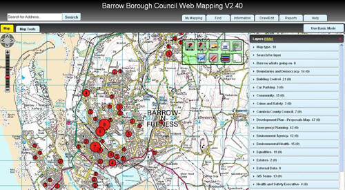
The right tool for the job
Barrow-in-Furness Borough Council has combined the use of open source software with the power of their Local Land and Property Gazetteer (LLPG) to meet local service delivery and EU regulations commitments, all while saving money.
The-right-tool-for-the-job.pdf
1.21 MB

31 October 2011
Bringing the past into the presentExemplar Award Winner- Winner National Gazetteers Naming Award: Colchester Borough Council

30 October 2011
Partnering for successExemplar Award Winner- Best Practice National Gazetteers Integration Award: Adur District Council and Worthing Borough Council

29 October 2011
Putting it all into the blender!Exemplar Award Winner- Highly Commended National Gazetteers Integration Award: London Borough of Harrow
29 October 2011
Modernising Electoral Data services in HuntingdonshireHuntingdonshire District Council have improved internal processes to ensure that the Electoral Register is continuously maintained with new and updated addresses for residential properties.
28 October 2011
Tackling under occupancy in social housingExemplar Award Winner- Runner-up National Gazetteers Integration Award 2011: Huntingdonshire District Council

26 October 2011
Sharing public sector asset management delivers savingsExemplar Award Winner- Winner National Gazetteers Integration Award 2011: Bristol City, South Gloucestershire, Bath & North East Somerset, North Somerset Councils, Police, Fire & Ambulance Emergency Services, Primary Care Trusts & the NHS in the greater Bristol Area

25 October 2011
Dealing with inefficiency and wasteExemplar Award Winner- Highly Commended National Gazetteers Financial Award: Northumberland County Council

24 October 2011
Please help yourselves!Exemplar Award Winner- Runner-up National Gazetteers Financial Award 2011: London Borough of Harrow

23 October 2011
A compelling changeExemplar Award Winner- Winner National Gazetteers Financial Award 2011: Barnsley Metropolitan Borough Council

22 October 2011
Closing the inequality gapExemplar Award Winner- Highly Commended National Gazetteers Citizen Award 2011: Warrington Borough Council

21 October 2011
Putting the heart back into Dartford’s Central ParkExemplar Award Winner- Runner-up National Gazetteers Citizen Award 2011: Dartford Borough Council

20 October 2011
UPRNs supporting Safer Stronger Communities and Safe Effective Fire-FightersExemplar Award Winner- Winner National Gazetteers Citizen Award 2011: Merseyside Fire and Rescue Service
10 October 2011
National Gazetteers LLPG and LSG Best in RegionThese awards were judged on overall quality of the LLPG and the LSG, looking at data quality and compliance to the Improvement Schedules.

10 October 2011
By popular demandExemplar Award Winner- Runner-up National Gazetteers Naming Award 2011: Chorley Borough Council
09 October 2011
Improvement = successNational Gazetteers Most Improved LLPG and LSG 2011 Exemplar Award Winners- • LLPG winner: Barnsley Metropolitan Borough Council • LSG winner

08 October 2011
Sharing knowledge, raising awareness - Newport City CouncilExemplar Award Winner- Winner National Gazetteers Peer Award 2011: Shaun Powell Newport City Council

07 October 2011
Mapping a greener futureExemplar Award Winner- Runner-up National Gazetteers Green Award 2011: Nottingham City Council

06 October 2011
Garden waste – more take-up, less landfill, greener outcomesExemplar Award Winner- Winner National Gazetteers Green Award 2011: Northumberland County Council

04 October 2011
An end to the paper trailExemplar Award Winner- Runner-up National Gazetteers Technology Award 2011: Northumberland County Council

03 October 2011
Monkey businessExemplar Award Winner- Winner National Gazetteers Technology Award and Award 2011: West Midlands Fire and Rescue Service
02 October 2011
Proactive street namingExemplar Award Winner- Best Practice National Gazetteers Naming Award 2011: Birmingham City Council
17 July 2011
Working together across the public sector
Local authorities are required to do more but with fewer resources. Citizens have high expectations of services, but no desire to see increases in Council Tax. With responsibility for delivering over 700 services, from the cradle to the grave, local authorities need to make the most of their information to deal with these challenges. One common key theme through nearly all these services is ‘where’ they are delivered.
working-together-across-the-public-sector.pdf
3.90 MB

10 July 2011
Building on what you’ve already gotExemplar Award Winner- Best Practice National Gazetteers Technology Award 2011: Northumberland County Council

20 May 2011
Kent Highway Services: using GIS for environmental protection
Kent County Council's Highway Services has been using the National Street Gazetteer (NSG) as a base and the Associated Street Data (ASD) as a means to record detailed environmental information.
Using-GIS-for-environmental-protection.pdf
156.56 KB
14 October 2010
A compelling business caseExemplar Award Winner- Winner NLPG NSG Exemplar Award ‘Financial Award’ 2010: London Borough of Harrow Best example of saving money using the NLPG/LLPG or the NSG/LSG
13 October 2010
Honouring the birthplace of Captain Myles StandishExemplar Award Winner- Highly Commended NLPG NSG Exemplar Award ‘Naming Award’ 2010: Chorley Borough Council
13 October 2010
Identifying play prioritiesExemplar Award Winner- Highly Commended NLPG NSG Exemplar Award ‘Citizen Award’ 2010: Canterbury City Council
12 October 2010
Preserving a seafaring pastExemplar Award Winner- Highly Commended NLPG NSG Exemplar Award ‘Naming Award’ 2010: Canterbury City Council
12 October 2010
A single version of the truthExemplar Award Winner- Runner Up NLPG NSG Exemplar Award ‘Citizen Award’ 2010: London Borough of Hackney
11 October 2010
Honouring the heroes of warExemplar Award Winner- Winner NLPG NSG Exemplar Award ‘Naming Award’ 2010: Plymouth City Council Most innovative example of street naming which is relevant to local history and geographical context
11 October 2010
Improving service through better communicationExemplar Award Winner- Winner NLPG NSG Exemplar Award ‘Citizen’s Award and winner of the 2010 Exemplar Award: West Oxfordshire District Council Best example of a project which delivers services to citizens underpinned by the NLPG/LLPG or the NSG/LSG LLPG
10 October 2010
Smart IT deliversExemplar Award Winner- Highly Commended NLPG NSG Exemplar Award ‘Technology Award’ 2010: Northumberland County Council
09 October 2010
Exemplar Award Winner Anglesey County Council - The right tools for the jobExemplar Award Winner- Runner Up NLPG NSG Exemplar Award ‘Technology Award’ 2010: Isle of Anglesey County Council
08 October 2010
Address intelligence by proxyExemplar Award Winner- Winner NLPG NSG Exemplar Award ‘Technology Award’ 2010: London Borough of Harrow Best example of an innovative application of technology using the NLPG/LLPG or the NSG/LSG
07 October 2010
Getting it right first timeExemplar Award Winner- Best Practice NLPG NSG Exemplar Award ‘Integration Award’ 2010: Fenland District Council
06 October 2010
Boundary changes – putting the gazetteer to workExemplar Award Winner- Highly Commended NLPG NSG Exemplar Award ‘Integration Award’ 2010: Huntingdonshire District Council
05 October 2010
Monitoring the changing face of the high streetExemplar Award Winner - Runner Up NLPG NSG Exemplar Award ‘Integration Award’ 2010: Chorley Council
04 October 2010
The golden threadExemplar Award Winner- Winner NLPG NSG Exemplar Award ‘Integration Award’ 2010: Cambridgeshire Fire and Rescue Service Best example of where the NLPG/LLPG or the NSG/LSG is linked to other council services or to local partnership
03 October 2010
Promoting self serviceExemplar Award Winner- Runner Up NLPG NSG Exemplar Award ‘Green Award’ 2010: Ashfield District Council
02 October 2010
Greening the boroughExemplar Award Winner- Winner NLPG NSG Exemplar Award ‘Green Award’ 2010: London Borough of Harrow Best example of where a service using the NLPG/LLPG or the NSG/LSG has either reduced environmental impact or increased greener outcomes
01 October 2010
All change on bin dayExemplar Award Winner- Runner Up NLPG NSG Exemplar Award ‘Financial Award’ 2010: Reigate and Banstead Borough Council

03 August 2010
Shared services in the New Forest
Read how New Forest District Council has developed a unique information sharing partnership with its town and parish councils that relies on business critical map information.
Shared-Services-in-the-New-Forest.pdf
81.58 KB

29 July 2010
Protecting vulnerable people in TorfaenDuring the Swine Flu epidemic in 2009 Torfaen County Borough Council had an urgent need to identify vulnerable people living in the borough. A system was needed which allowed Emergency Planning, Social Services, and other relevant departments to spatially identify people at risk at short notice.
25 May 2010
2010 Exemplar Awards case study booklet
case-studies-from-the-2010-NLPG-and-NSG-Exemplar-Awards.pdf
4.47 MB

20 May 2010
Spatially-enabled services in Southwark
The London Borough of Southwark offers its citizens a spatially-enabled one-stop shop through a state-of-the-art web mapping platform. This is underpinned by council data which is intelligently linked.
Spatially-enabled-services-in-Southwark.pdf
172.88 KB

19 May 2010
Extra Care Sheltered Housing programme
Swindon Borough Council is increasingly using geographical information (GI) in the commissioning and delivery of health and social care services. The council and local primary care trust (PCT) worked in partnership to plan the Extra Care Sheltered Housing programme using GI resources.
Extra-Care-Sheltered-Housing-Programme.pdf
56.96 KB

19 May 2010
Breaking out of the silo - West Midlands Regional Observatory
The West Midlands Regional Observatory (WMRO) is an excellent example of cross-organisation and cross-departmental working.
Breaking-out-of-the-silo.pdf
68.84 KB

29 October 2009
It’s only rock ‘n’ rollNLPG NSG Exemplar Award Winner – Most Interesting Anecdote or Street Name 2009: Dartford Borough Council.

29 October 2009
Joining forces to improve street work coordinationNSG Exemplar Award Runner up – Most Effective LSG and Street Works Integration 2009: Dorset County Council.
27 October 2009
Underpinning unificationNLPG Exemplar Award Runner Up – Best Business Process Transformation 2009: Cornwall Council.

22 October 2009
Engaging the voterExemplar Award Winner – MoJ Award for Best Implementation of the Electoral Register Data Standard 2009: Tandridge District Council.

20 October 2009
Positively engaging with improvementNLPG Exemplar Award Winner – FiReControl Award for the Best Integration of the NLPG by a Fire & Rescue Service 2009: Lincoln Fire and Rescue.

20 October 2009
The wheels on the busNLPG Exemplar Award Runner Up – Most Effective Data Sharing Partnership 2009: East Riding of Yorkshire Council.

20 October 2009
Data sharing and early interventionNLPG Exemplar Award Winner – Most Effective Data Sharing Partnership 2009: Nottingham City Council.

20 October 2009
One address, one boundary, one councilNLPG Exemplar Award Best Practice – Best Business Process Transformation 2009: Chorley Council.


20 October 2009
Better allotment provisionNLPG Exemplar Award Highly Commended – Most Innovative Use 2009: Canterbury City Council.

14 October 2009
Improvements in rural WalesNSG Exemplar Award Winner Most Improved – Best In Wales 2009: Isle of Anglesey County Council.

14 October 2009
You only need to tell us onceNLPG Exemplar Award Runner UP – MoJ: Best Implementation of the Electoral Registration Data Standard 2009: High Peak Borough Council and Staffordshire Moorlands District Strategic Alliance.

13 October 2009
NSG best performing region & NSG best in regionNSG Exemplar Award Winner – Best Performing Region 2009: Yorkshire and Humberside.

08 October 2009
Improving the improvedNLPG Exemplar Award Runner Up – FiReControl Award for the Best Integration of the NLPG by a Fire & Rescue Service 2009: Kent Fire & Rescue Service.

07 October 2009
West Midlands Business Matters projectNLPG NSG Exemplar Award Winner Best Partnership Between Organisations 2009: Lichfield District Council, Dudley Metropolitan Borough Council, Solihull Metropolitan Borough Council and Business Link West Midlands.

07 October 2009
Create once use many times - Newport City CouncilNLPG Exemplar Award Best Practice – Best Business Process Transformation 2009: Newport City Council.


06 October 2009
Redefining what’s what and whereNSG Exemplar Award Highly Commended – Best Integration of the NLPG and NSG 2009: Monmouthshire County Council.

06 October 2009
Addressing the technological divideNSG Exemplar Award Winner – Most Effective NSG and Street Works Integration 2009: Blackpool Council.

06 October 2009
Fighting crime the Salford City wayNLPG Exemplar Award Winner – Most Innovative Use 2009: Salford City Council.

05 October 2009
The rediscovered treasure
02 October 2009
An expression of disdainNLPG NSG Exemplar Award Winner – Most Interesting Anecdote, Address or Street Name 2009: Devon County Council.

02 October 2009
Improving democracy
01 October 2009
Keeping warm sustainablyNLPG NSG Exemplar Award Runner up – Best Partnership Between Organisations 2009: Nottingham City Council.

01 October 2009
Intelligent updating of live systemsNLPG Exemplar Award Highly Commended – Best Business Process Transformation 2009: Exeter City Council.

01 October 2009
Underpinning transformational government
Series of case studies from the 2009 Exemplar Awards. 'Celebrating 10 years of the NLPG'
Underpinning-transformational-government-celebrating-10-years-of-the-NLPG.pdf
4.74 MB

25 September 2009
Shropshire Council: streamlining management information
Discover how Shropshire Council has refined its processes for maintaining street and address information.
Shropshire-Council-streamlining-management-information.pdf
129.99 KB

25 August 2009
Nottingham City Council: getting the figures right
Nottingham City carried out an innovative project producing population figures excluding students living in the area. This resulted in more accurate figures and targets and new areas of need being identified.
Getting-the-figures-right.pdf
59.33 KB
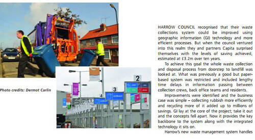
25 May 2009
Where there's muck...there's happy residents!
This GIS Professional article describes how Harrow has implemented GI through the NLPG across its activities, delivering major cost savings, winning awards and more importantly, providing better services to residents.
Where-theres-muck.pdf
1.94 MB

20 May 2009
Confronting the issues: Lincolnshire Fire and Rescue
Lincolnshire Fire and Rescue Service (LFRS) was been involved in a data capture and migration exercise. This was to align its current gazetteer with the National Land and Property Gazetteer (NLPG) in preparation for the FiReControl initiative.
Confronting-the-issues-Lincolnshire-Fire-and-Rescue.pdf
957.91 KB

16 January 2009
Fighting the flu in Swindon
In response to the 2008 NHS Flu Pandemic Planning programme, Swindon Borough Council and Swindon Primary Care Trust (PCT) needed to find a suitable location for a flu contact centre.
Fighting-the-flu-in-Swindon.pdf
64.11 KB

29 October 2008
A community in profileNLPG Exemplar Award Highly commended – Most creative use 2008: Chorley Council.
28 October 2008
Long term business process re-engineeringNLPG Exemplar Award Runner-up – Best business process transformation 2008: Chiltern District Council.

27 October 2008
At the frontline of service deliveryNLPG Exemplar Award Highly commended – Best business process transformation 2008: Blackpool Council.

24 October 2008
Together we are strongerNLPG Exemplar Award Runner-up – Best use of NLPG data by a partner 2008: City of Durham Council.

22 October 2008
Award winning recyclingNLPG Exemplar Award Runner-up – Best business process transformation 2008: Mid Devon District Council.

22 October 2008
It’s all in the nameNSG Exemplar Award Runner-up – Most innovative use of additional street data 2008: South Oxfordshire District Council.

22 October 2008
Fighting the fear of crimeNLPG Exemplar Award Runner-up – Best use of NLPG data by a partner 2008: Sedgefield Borough Council.

21 October 2008
A picture paints a thousand wordsNSG Exemplar Award Runner-up – Most creative use of level 3 NSG 2008: Kent Highway Services Alliance.

20 October 2008
Building intelligence for council contractsNLPG Exemplar Award Runner-up – Most creative use 2008: Royal Borough of Kingston upon Thames.
20 October 2008
Warwickshire County Council Most Improved 2008NSG Exemplar Award – Most improved 2008: Warwickshire County Council.

20 October 2008
At the heart of governmentNLPG Exemplar Award Highly commended – Best business process transformation 2008: Caradon District Council.

16 October 2008
Targeting energy efficiencyNLPG Exemplar Award Winner – Most creative use 2008: Dartford Borough Council.

15 October 2008
Monitoring migration to meet service expectationsNLPG Exemplar Award Runner-up – Most creative use 2008: London Borough of Barking and Dagenham.

14 October 2008
The ultimate mailing listNLPG Exemplar Award Highly commended – Most creative use 2008: Shepway District Council.
13 October 2008
London Borough of Lewisham Most Improved 2008NLPG Exemplar Award – Most improved 2008: London Borough of Lewisham.

10 October 2008
Building a gazetteer for the futureNLPG NSG Exemplar Award Runner-up – Best integrated use of the NLPG and NSG 2008: Monmouthshire County Council.

10 October 2008
Better cheaper fasterNSG Exemplar Award Winner – Best streetworks application 2008: London Borough of Camden.

09 October 2008
Protecting a fragile environmentNSG Exemplar Award Winner – Most innovative use of additional street data 2008: Kent Highway Services Alliance.

08 October 2008
NLPG to the rescueNLPG Exemplar Award Runner up – Best business process transformation 2008: Surrey Fire and Rescue Service.

08 October 2008
Enabling informed decision makingNLPG Exemplar Award Winner – Best use of NLPG data by a partner 2008: Nottingham City Council.

07 October 2008
Better streetworks controlNSG Exemplar Award Runner-up – Best streetworks application 2008: Conwy County Borough Council.

02 October 2008
Improved service delivery through avoidable contactNLPG Exemplar Award Winner – Best business process transformation 2008: South Tyneside Council.

02 October 2008
Easier fault reportingNLPG NSG Exemplar Award Winner – Best integrated use of the NLPG and NSG 2008: London Borough of Haringey.
01 October 2008
Best integration of the NLPG and NSG 2008NLPG NSG best integration of the NLPG and NSG 2008: Bury Metropolitan Borough Council, London Borough of Brent, London Borough of Ealing, London Borough of Lewisham, London Borough of Sutton, Luton Borough Council, Warrington Borough Council.

01 October 2008
Looking for holesAlliance NSG Exemplar Award Runner-up – Best streetworks application 2008: Kent Highway Services.
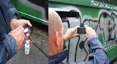
30 September 2008
Bedfordshire Community Safety Partnerships SCRIBE project
The Bedfordshire Community Safety Partnerships developed an innovative data sharing system, SCRIBE, to support partnership working to tackle crime and anti-social behaviour in Bedfordshire.
Bedfordshire-Community-Safety-Partnerships.pdf
65.70 KB

16 September 2008
Dudley's got a GIS-MO: project case study
Dudley Metropolitan Borough Council has developed an in-house geographic information (GI) service that has become a business critical product within the company.
Dudley-got-a-gis-mo.pdf
97.66 KB
17 July 2008
Everything happens somewhere
Case studies from the 2008 NLPG and NSG Exemplar Awards, demonstrating the importance of definitive data in transforming government
Case-studies-from-the-2008-NLPG-and-NSG-Exemplar-Awards.pdf
5.34 MB

20 May 2008
Cambridgeshire Fire & Rescue seeks harmony
Cambridgeshire Fire and Rescue Service (CFRS) has harmonised the address data it uses in preparation for the FiReControl project.
Cambridge-Fire-Rescue-seeks-harmony.pdf
64.30 KB

20 May 2008
Accurate incident location in Surrey
Surrey Fire and Rescue Service (SFRS) has built a state-of-the-art dynamic mobilisation system. This dramatically speeds up response times to incidents.
Accurate-incident-location-in-Surrey.pdf
992.59 KB

03 April 2008
National Park Case Study
National Parks like Local Authorities, the Police and the Fire and Rescue services are eligible to use the NLPG in their day-to-day business.
New-Forest-National-Park-case-study.pdf
1.48 MB

31 October 2007
A building block for successNLPG Exemplar Award: Highly Commended – ‘Best Business Process Transformation’ 2007: Suffolk Coastal District Council.

23 October 2007
At the heart of a virtual regenerationNLPG Exemplar Award: Highly Commended – ‘Best Business Process Transformation’ 2007: Blackpool Council.

23 October 2007
Joining up service deliveryNLPG Exemplar Award: Winner – ‘Best Business Process Transformation’ 2007: Plymouth City Council.

18 October 2007
Underpinning conservationBest Practice for use of Polygons 2007: Surrey Heath Borough Council.

17 October 2007
Gazetteer improvements lead to better online service accessNLPG Most Improved 2007: London Borough of Hackney.

17 October 2007
Size mattersNSG Exemplar Award: Winner – ‘Best Business Integration’ 2007: Devon County Council.

17 October 2007
The NLPG vision made realityNLPG Exemplar Award: Winner – ‘Best Performing Authority’ 2007: Huntingdonshire District Council.

17 October 2007
As the rain came downNLPG Exemplar Award: Winner – ‘Most Creative Use’ 2007: Kingston-upon-Hull City Council.

15 October 2007
The road to successNSG Exemplar Award: Winner – ‘Best Gazetteer Integration’ 2007: Devon County Council.

12 October 2007
Sharing the knowledge - Huntingdonshire District CouncilNLPG Exemplar Award: Highly Commended – ‘Most Creative Use’ 2007: Huntingdonshire District Council.

10 October 2007
A timely processBest Practice for Street Naming and Numbering 2007: Fenland District Council.

09 October 2007
Catching up and keeping abreast of changeNLPG Most Improved 2007: Salford City Council.

09 October 2007
A working street gazetteerNSG Exemplar Award: Winner – ‘Best Performing Authority’ 2007: Southend-on-Sea Borough Council.

04 October 2007
Picking up the piecesNSG Exemplar Award: Highly Commended – ‘Best Gazetteer Integration’ 2007: Kingston-upon-Hull City Council.

03 October 2007
All for one and one for allBest Practice for Quality Process Improvement 2007: Caradon District Council.

03 October 2007
Safety in numbersNLPG Exemplar Award: Highly Commended – ‘Most Creative Use’ 2007: Dartford Borough Council.

02 October 2007
Investing to create a corporate infrastructureNLPG Most Improved 2007: Thurrock Council.

02 October 2007
Proving protocol paysNSG Exemplar Award: Highly Commended – ‘Best Gazetteer Integration’ 2007: Kent Highways Alliance.

01 October 2007
Taking it to the streetsNSG Exemplar Award: Highly Commended – ‘Best Business Integration’ 2007: Tameside Metropolitan Borough Council.

01 October 2007
From nowhere to knowing whereNSG Exemplar Award: Highly Commended – ‘Best Business Integration’ 2007: Somerset Highways.
17 July 2007
Improving efficiency and service delivery
Case studies from the 2007 NLPG and NSG Exemplar Awards, demonstrating benefits for authorities and citizens.
improving-effiency-and-service-delivery.pdf
2.46 MB
31 October 2006
Improving efficiency and service delivery through vision and actionNLPG Exemplar Award: Highly Commended – ‘Best use with partners’ 2006: London Borough of Haringey.
27 October 2006
Create once use many times - Huntingdonshire District CouncilNLPG Exemplar Award: Winner – ‘Best use with partners’ 2006: Huntingdonshire District Council.
26 October 2006
Keeping citizens informed about refuse collectionsNLPG Exemplar Award: Winner – ‘Best Use Internally’ 2006: Sedgefield Borough Council.
23 October 2006
Transforming service delivery through the corporate gazetteerNLPG Exemplar Award: Winner – ‘Most Improved’ 2006: Dartford Borough Council.
17 October 2006
Web mapping system delivers cross-council addressingNLPG Exemplar Award: Highly Commended – ‘Best Use Internally 2006: Leicester City Council.
17 October 2006
Underpinning past and future service deliveryNSG Exemplar Award: Winner – ‘Most Creative Use’ 2006: Sandwell Metropolitan Borough Council.
16 October 2006
Powering the CRMNLPG Exemplar Award: Highly Commended – ‘Best use with partners’ 2006: Bolton Metropolitan District Council.
15 October 2006
Improved access to council services via digital TVNLPG Exemplar Award: Winner – ‘Most Creative Use’ 2006: London Borough of Brent.
11 October 2006
Improving access to council servicesNLPG Exemplar Award: Highly Commended – ‘Most Improved’ 2006: London Borough of Lambeth.
11 October 2006
Best practice across two tier authoritiesNSG Exemplar Award: Winner – ‘Best Integration’ 2006: Kent County Council.
09 October 2006
Property intelligence advances gazetteerNLPG Exemplar Award: Highly Commended – ‘Most Creative Use’ 2006: Chorley Borough Council.
06 October 2006
Gazetteer management on a shoestringNLPG Exemplar Award: Highly Commended – ‘Most improved’ 2006: Richmondshire District Council.
04 October 2006
Underpinning in house processes and public service deliveryNLPG Exemplar Award: Highly Commended – ‘Best Use Internally’ 2006: Stockton-on-Tees Borough Council.
03 October 2006
Partnership in actionNSG Exemplar Award: Highly Commended – ‘Best Integration’ 2006: Durham County Council.
02 October 2006
Overcoming obstacles to gazetteer creation in a rural contextNLPG Exemplar Award: Highly Commended – ‘Most Improved’ 2006: South Hams District Council.
02 October 2006
Assuring service delivery through integrationNSG Exemplar Award: Highly Commended – ‘Best Integration’ 2006: Swindon Borough Council.
27 July 2006
Leveraging the power of the UPRNNLPG Exemplar Award: Highly Commended – ‘Most Creative Use’ 2006: South Somerset District Council.
17 July 2006
Delivering better services to citizens
delivering-better-services-to-citizens.pdf
2.92 MB
23 October 2003
Better addressing, better workflow, better servicesDelivering service improvement through addressing: Winchester City Council.
22 October 2003
Reaping the benefits of authoritative addressingDelivering service improvement through addressing: Staffordshire Moorlands District Council.
21 October 2003
A data-rich framework for service developmentDelivering service improvement through addressing: Tandridge District Council.
16 October 2003
Stepping into the ‘spatial age’Delivering service improvement through addressing: Royal Borough of Kingston-upon-Thames.
15 October 2003
Minimising costs for maximum benefitDelivering service improvement through addressing: Torbay Council.
15 October 2003
Small district council makes big LLPG progressDelivering service improvement through addressing: South Derbyshire District Council.
13 October 2003
Reducing maintenance costsDelivering service improvement through addressing: Aylesbury Vale District Council.
09 October 2003
Customer focus drives innovative partnershipsDelivering service improvement through addressing: Royal Borough of Kensington and Chelsea.
08 October 2003
Joining forces and data to tackle recyclingDelivering service improvement through addressing: Forest Heath District Council.
07 October 2003
How to address your customersDelivering service improvement through addressing: High Peak Borough Council.
06 October 2003
Opening the door to improved customer serviceDelivering service improvement through addressing: Durham City Council.
04 October 2003
Connecting with citizens through call centresDelivering service improvement through addressing: Kingston-upon-Hull City Council.
03 October 2003
Improving decision making authority-wideDelivering service improvement through addressing: Stoke-on-Trent City Council.
02 October 2003
High-quality addressing means high-quality servicesDelivering service improvement through addressing: South Gloucestershire Council.
02 October 2003
Streets ahead with online servicesDelivering service improvement through addressing: Amber Valley Borough Council.
01 October 2003
Providing improved access to the planning processDelivering service improvement through addressing: Huntingdonshire District Council.
12 September 2003
Providing access to services onlineDelivering service improvement through addressing: London Borough of Brent.
17 July 2003
Delivering service improvement through addressing
delivering-service-improvement-through-addressing.pdf
842.29 KB

Case Study
Predicting and preventing fires using predictive analytics and the UPRN
Bringing Location to Life - case study based on a presentation from Apollo Gerolymbos, Head of Data Analytics at London Fire Brigade at the GeoPlace conference 2019
View Article
Case Study
Using location data and technology of today to reveal the secrets of the past
View Article
Case Study
How to avoid letting off steam
Bringing Location to Life - case study based on a presentation from Gareth Osborne, Senior Address Management Officer, Nottingham City Council at the GeoPlace conference 2019
View Article
Case Study
Tertiaries 'R' Us
Bringing Location to Life - case study based on a presentation from Mary Burton, Address Management Officer, Nottingham City Council at the GeoPlace conference 2019
View Article
Case Study
Using the UPRN to scrutinise government activity and understand delivery at a local level
Bringing Location to Life - case study based on a presentation from Dr Marc Adams, Senior Analyst and MESH Mapping Lead, National Audit Office at the GeoPlace conference 2019
View Article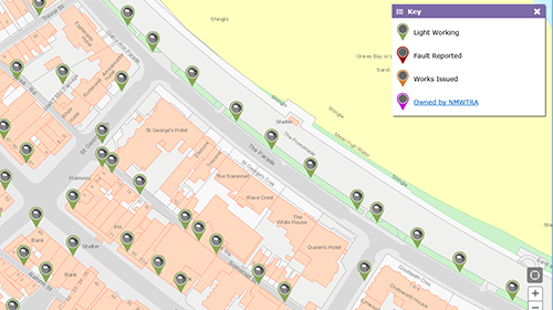
Case Study
Highways Asset Management - Street Lighting Portal
Through creativity and innovative use of accurate geospatial data, Conwy has managed to transform and modernise their asset management system to work for them.
View Article
Case Study
Linking people and places The Nation’s Census Address Custodians are our unsung heroes
Our Address Custodians are a nationwide force to be reckoned with – and as experts in addressing, they’re likely to be the unsung heroes of the 2021 Census.
View Article
Case Study
Kent integrated Database – using the UPRN to support health and care providers
The Kent Integrated Databset (KID) is a whole population pseudonymised person level linked dataset based on data flows from hundreds of local health and care providers in Kent & Medway
View Article
Case Study
Mid Sussex District Council - using UPRNs to secure £2.2m Government funding for local broadband improvements
Linking people and places - case study from Exemplar Awards 2018
View Article
Case Study
London Borough of Lewisham uses UPRNs to transform borough-wide services for residents
Linking people and places - case study from London Borough of Lewisham for GeoPlace Exemplar Awards 2018
View Article
Case Study
Sefton Council - UPRNs help to improve the standard of living in rented accommodation
Linking people and places - case study from Sefton Council for GeoPlace Exemplar Awards 2018
View ArticleGet in touch with GeoPlace
If you would like more information on any of these projects or would like work with us to showcase your own use of address and street data